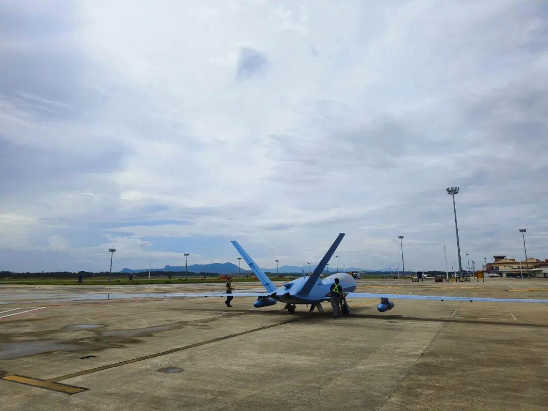
In recent years, China has achieved remarkable advances in meteorological science, with the development of the “Haiyan” drone standing out as a major breakthrough. Created by the China Aviation Industry Group (AVIC), this unmanned aerial vehicle (UAV) has become an essential tool for improving the ___1___ (accurate) of typhoon forecasts.
The Haiyan series consists of two main types of drones ___2___ (tailor) for different observation tasks. The Haiyan I is built on the Wing Loong-10 platform, a jet-powered UAV capable of flying at high altitudes — up to 14 kilometers — at great speeds. In contrast, the Haiyan II uses the Wing Loong-2 airframe and is designed for ___3___ (endure). It can remain airborne for over ten hours, making it perfectly suited for long-term monitoring of large-scale weather phenomena.
The primary mission of the Haiyan drone is ___4___ (gather) atmospheric (大气的) data from remote or hazardous areas where human access is difficult. It is equipped with an advanced dropsonde (掷降探空仪) system: small sensor devices attached to parachutes are released from the drone during flight. As these dropsondes ___5___ (descend), they measure key variables such as temperature, air pressure, humidity, and wind speed. The collected data is transmitted in real time to the drone and then ___6___ (relay) to scientists on the ground. This process offers a detailed three-dimensional profile of the atmosphere within a weather system, greatly improving our understanding of storms like typhoons.
The Haiyan drone has already proven its ___7___ (practice) worth. In June 2025, for instance, the Haiyan I operated at an altitude of 11,000 meters to observe Typhoon “Butterfly”, setting a new record. ___8___ typhoons, the Haiyan II has also been deployed to study other complex weather patterns, such as the Northeast Cold Vortex, and to provide meteorological support for major events including the 2025 World Games.
Before the introduction of such drones, scientists relied mainly on satellites to monitor ocean-based typhoons. While satellites offer valuable large-scale views, they cannot capture ___9___ (detail) vertical measurements of the atmosphere. The Haiyan drone fills this gap — the high-resolution data it gathers is fed into advanced forecasting models at research centers, ___10___ (lead) to more accurate predictions of a typhoon’s path, intensity, and rainfall.